
Prescott Block Lookup Sources
The block method begins with Yavapai GIS because it exposes the subject parcel and every adjoining polygon. Each click can show an indexed owner, situs, parcel number, tax mailing destination, improvements, sales, permits, and districts. Those are property facts, not a census of people. Deeds add transfer parties, permits add work dates, and the 1963 criss-cross can add a listed historic subscriber or occupant.
| Source | What It Shows About a Block | Access |
|---|---|---|
| GIS click, select, buffer | Parcel shapes, owners, situs, APNs, districts | Free public map |
| Assessor parcel sheet | Owner, tax mail, values and improvements | Free printable result |
| Recorder deeds | Ownership transfers along the block | Index; images from 1976 |
| Permit panel | Property-work timing | Mostly mid-2000s forward |
| 1963 criss-cross | Listed historic address occupants | Archive or restricted digital copy |
| Civic groups | Public board and organization contacts | Public pages, not household rosters |
A tax mailing address may be somewhere else. That can signal where a bill goes, but does not show who sleeps at the parcel. Arizona's automatic homestead creditor protection is also not a parcel checkbox for owner occupancy. Compare sources without merging them.
Click Prescott Parcels Next Door
Search the subject address in Yavapai County Interactive Map, zoom to parcel scale, and click each adjoining polygon. Identify and Select can load several parcels into one comparison set. Roads, parcels, and lots update daily, while business attributes may lag several weeks. The boundaries are fitted from deed evidence and are not survey-grade legal lines.
The block can be read outward in a fixed order: subject address to parcel, parcel to touching polygons, each polygon to owner and situs, then selected parcels to deed or permit evidence. Parcel History should be checked when a split or combination makes one lot appear to vanish.
For a whole named road rather than the immediate block, use the Prescott Street Directory and its road-segment workflow.
Buffer a Prescott Block
The county map offers a systematic alternative to manual clicks. Select the subject parcel, choose Buffer Parcel, enter a distance, and run the tool. The county recommends no more than one mile. Every intersecting parcel is highlighted and can be inspected. The loaded selection can also be exported to CSV as a mailing list, while Quick Measure checks distance or area.
This makes the block method reproducible. Keep the buffer distance, search date, and selected parcel list with the research notes. A buffer still reports parcels and indexed owners, not all people on the block who occupy those places.
Comparison tip. Match situs to the mapped polygon and treat tax mailing as a separate destination for every parcel.
Map a Prescott Block Carefully
A disciplined adjacent-parcel search avoids the common leap from owner to occupant. The county map is a strong property switchboard because it joins parcels with owners, physical addresses, recorded sales, permits, and districts. Yet no panel promises a live household roster.
Use one search date for the whole block so later ownership changes do not mix two different snapshots.
- Find the address and verify the selected situs and parcel number.
- Click every parcel sharing a boundary, or run a stated buffer distance.
- Record owner, situs, tax mailing destination, parcel lineage, and search date separately.
- Open sales, deed, or permit evidence only for the parcel question being tested.
- Export the selected set when a consistent block inventory is needed.
Note: Mailing and situs addresses may match, but that match alone still does not prove who occupies the property.
Prescott Block Deeds and Permits
Recorder sales and deeds show how ownership changes across a block. The Yavapai Recorder maintains the index and offers a free Recorded Document Alert for subscribed names or businesses. An alert provides basic recording information and a document link, but a same-name hit must be verified.
Consult the official Recorder page before viewing this Prescott block record source.
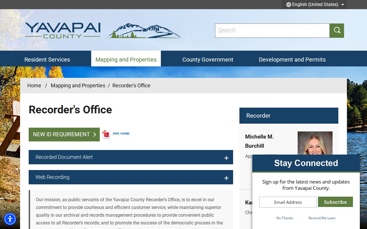
The Recorder layer documents transfers. It does not identify every person living on the block.
Permits can date demolition, additions, electrical, fence, mechanical, and other work. GIS contains mainly mid-2000s-forward permit data, but it is not exhaustive. The Prescott permit portal serves applicant actions such as plans, corrections, payments, and inspections; absent public details may require a city records request.
Open PrescottPermits before viewing the source screen used for the nearby parcel permit layer.
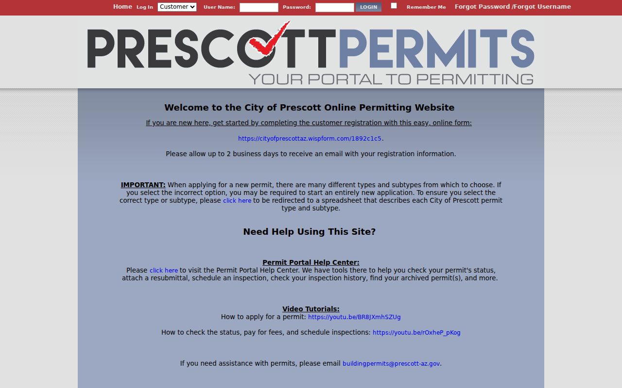
A permit can mark property change, not household occupancy.
Prescott Blocks and Voter Data
Arizona voter information is not an open neighbor finder. The self-service portal lets a voter confirm that person's own registration, districts, ballot status, and participation history. A.R.S. §16-168 limits broader file inspection and copies to political or party activity, campaigns and elections, redistricting, or another legally authorized purpose. Internet redistribution is forbidden without authority.
Publicly handled fields can include name, residence, a separate mailing address, party, registration status, precinct, districts, and participation history within those limits. Ballot choices are never shown. Birth details, identification numbers, signature, email, and protected addresses remain confidential.
Read Arizona's official voter-file limits before viewing the Prescott block-lookup source below.
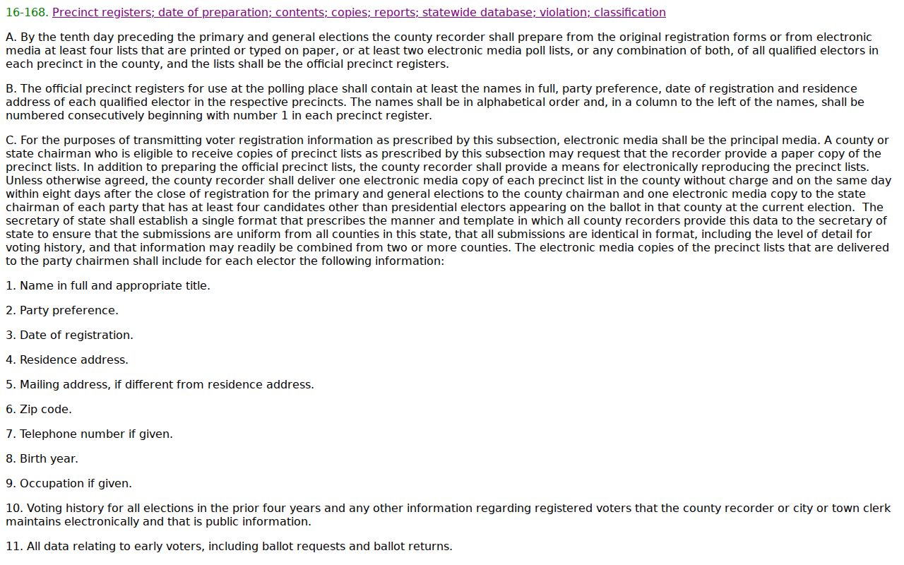
The statute explains why a lawful block method must rely on property geography rather than promise open voter browsing.
Named Prescott Neighborhood Geography
Authoritative association evidence is limited, but Prescott's Consolidated Plan identifies Dexter, Gail Gardner, and West Side as wholly or partly within CDBG target areas. The Dexter Neighborhood Plan from 2000 addresses single-family character, riparian areas, mature trees, granite outcrops, and compatible development. These are named geographies, not resident lists.
Dexter
Named planning area with an adopted neighborhood plan. No public household roster was verified.
Gail Gardner
Named in the city planning context. Use parcel and public civic records for specific places.
West Side
Recognized local geography in the Consolidated Plan, not a directory of people on the block.
The Prescott Downtown Partnership brings together businesses, owners, residents, government, and nonprofit stakeholders. The Chamber directory publishes organization names, addresses, phones, membership dates, and links. Both help locate civic contacts, but neither should be converted into a private resident roster.
Historic layers can explain why adjoining parcels do not share one simple record path. Prescott's original 1864 core and cemetery were followed by Whipple Heights in 1908, Joslin subdivisions in the 1920s, Joslin-Whipple in 1935, and later annexation. The Citizen's Cemetery, Smoki, and Armory vicinity entered Prescott through a September 1925 annexation. County or subdivision evidence may therefore predate city evidence for the same modern block.
Downtown blocks need a different mix than later residential parcels. Courthouse Plaza and the brick commercial core rebuilt after the 1900 fire call for business directories, Sanborn sheets, leases, and historic survey work alongside deeds. The fire destroyed the young library collection, but no authoritative source says it destroyed county deed books. That limit keeps local history from becoming a false records-gap claim.
Official Prescott Neighbor Evidence
Commercial neighbor compilations merge public and marketing data. They can be stale or attach the wrong person to an address. Official rolls are narrower but disclose their keeper, fields, date, and correction route. Use the source that answers the actual question.
| Source type | Strength | Limit |
|---|---|---|
| County GIS and Assessor | Parcel, owner, situs and district context | Not a household roster |
| Recorder documents | Named transfer parties and dates | Not proof of residence |
| Permits | Property-work timing | Incomplete and not occupancy evidence |
| Commercial compilation | Broad merged leads | May be stale or confuse names |
For a correction, contact the keeper. The Assessor handles parcel facts, the Recorder handles document indexing, and Prescott handles its municipal record. A compilation's opt-out does not change the official roll.
Prescott Block Project Contacts
Property work can connect a block to a licensed contractor or technical professional, but the business link is not a residence clue. Arizona's official contractor search is free, available without registration, and can filter by status, company or person, city, license type, and classification. Only Current or Active licensees may contract.
Use the official Arizona contractor search before viewing the project-contact source for the Prescott block.
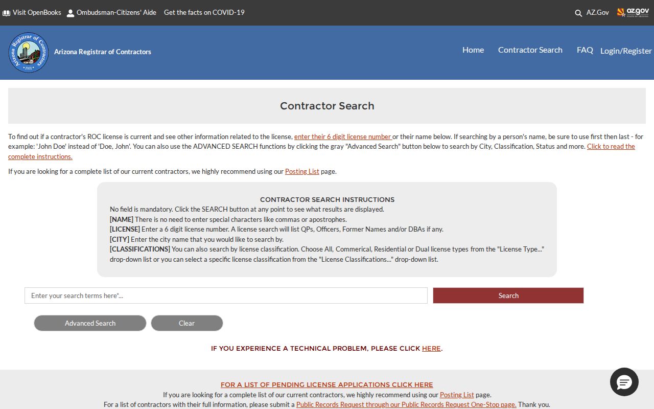
The result can verify a public project contact tied to permitted work, not identify a private household.
Prescott Neighbors Privacy Limits
Renters, family members, and other occupants do not appear on the property roll merely because they live at an address. Utility and delivery customer data is not an open list. Eligible people can protect Recorder, Assessor, Treasurer, and voter addresses, while Arizona's Address Confidentiality Program provides a substitute address to qualifying survivors through registered application assistants.
Lawful use. Prescott block research supports civic curiosity and personal safety. Never use it to watch, harass, intimidate, or harm anyone.
No authoritative citywide HOA, neighborhood-association, congregation, or block-watch membership directory was found. Private rosters should stay private. The block method ends with documented ownership and public civic contact, not every person behind each door.
Protected-address rules matter at block scale because even a small set can expose a person's location. Arizona's program began in 2012, uses in-person applications through registered assistants, and can forward first-class, registered, certified, and election mail. Eligible people may also seek court orders for custodian-specific address protection. The correct outcome when a field is suppressed is to stop, not to reconstruct it from nearby records.